Insurance
Whether your data collection is a baseline analysis or disaster response, Havoc Systems can provide accurate UAV information that can be accessed quickly for assessment and informed decision making. For baseline data, we can survey a property, including land slope, tree lines, roof inspection, water run-off, and coastal erosion. We are able to map out an area with orthomosaic maps in both 2D and 3D to show an accurate representation of land and buildings. With high resolution photos, we can map trees, vegetation, and roof conditions, allowing for an overall assessment of a property.
As for disaster response, like our First Responder work, we can provide rapid response data collection. In dealing with fires, storms, or other disasters, assessing damage quickly is paramount for insurance companies to understand potential risk. This data allows insurance companies make informed decisions with accurate and defensible data.
Roof Inspection Survey - Video

PLOT SURVEY REPORTING
A variety of maps can be produced from a single flight and post-process tools allow for accurate measurements and detailed understanding of an area.

Structure Assessment
We can provide structural assessments, roof and tree inspection. We are also able to identify conflict of water run-off and erosion. These high resolution images and maps allow an insurance company the ability to insure a property accurately and allows you to have a baseline of before and after a claim.
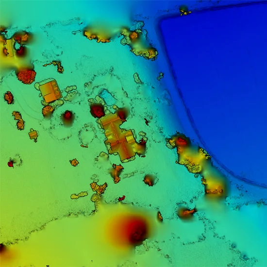
Elevation Models
These maps show storm damage and potential erosion issues for long term monitoring and allows for preemptive solutions.